| Magnitude | 5.1 |
| Region | MYANMAR |
| Date time | 2026-02-25 16:51:46.8 UTC |
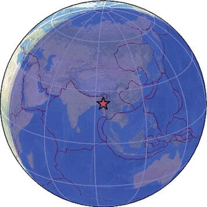
| Location | 23.062 ; 94.792 |
| Depth | 101 km |
| Distance | 112 km NNW of Monywa, Myanmar / pop: 182,000 / local time: 23:21:46.8 2026-02-25 76 km SE of Mawlaik, Myanmar / pop: 44,500 / local time: 23:21:46.8 2026-02-25 |
Source parameters reviewed by a seismologist
All data providers for this event:
Geoscience Australia, Canberra, ACT, Australia -- Canberra, Australia (AUST)National Institute for Earth Physics -- Bucharest, Romania (NIEP)
HUN-REN EPSS Kövesligethy Radó Seismological Observato -- Budapest, Hungary (BUD)
EMSC - CSLOC -- Arpajon, France (CSLC)
Badan Meteorologi, Klimatologi dan Geofisika -- Jakarta, Indonesia (BMKG)
GeoForschungsZentrum (GFZ) -- Potsdam, Germany (GFZ)
Geophysical Survey of the Russian Academy of Sciences -- Obninsk, Russia (GSRAS)
Instituto Portugues do Mar e da Atmosfera -- Lisbon, Portugal (IPMA)
Slovenian Environment Agency, Seismology Office -- Ljubljana, Slovenia (ARSO)
Ukrainian NDC, Main Center of Special Monitoring -- Kyiv, Ukraine (MCSM)
Malaysian Meteorological Department -- Kuala Lumpur, Malaysia (MET)
India Meteorological Department, New Delhi, India -- New Delhi, India (NDI)
National Earthquake Information Center, U.S. Geological Survey -- Golden, United States (NEIC)
Centro de Sismologia da Universidade de Sao Paulo (member of the RSBR) -- Sao Paulo, Brazil (USP)
Republican Seismic Survey Center or Azerbaijan National Academy of Sciences -- Baku, Azerbaijan (RSSC)
EMSC -- Arpajon, France (SC4)
Thailand Seismological Bureau -- Bangkok, Thailand (TSB)
Further information can be found at:
GeoForschungsZentrum (GFZ) -- Potsdam, Germany (GFZ)National Earthquake Information Center, U.S. Geological Survey -- Golden, United States (NEIC)